Saturday we got to go hike at Coopers Rock. The main gate was closed and the Day Use Parking lot was filled with people like us who were taking advantage of the nice (45 degree) weather.
We had prepared for a nice long adventure hike, with snacks and canteens and even extra layers. The woods did not disappoint. We hiked four miles Saturday, according to my GPS Pal app. And Delia only lodged four complaints, that's not too bad at all!
The winter storms really did a number on our trail. There were trees down all over the place, blocking the trail. We did a good bit of climbing and skirting around the arboreal carnage. In a couple of places the trees that had fallen took parts of the trail with them! It was exciting, but I wonder when the parks service will have the time or money to get it all cleaned up.
Showing posts with label hiking. Show all posts
Monday, March 25, 2013
Monday, June 04, 2012
Scenes from Horseshoe National Recreation Area
During this camping trip, Delia expressly forbid me to put any photographs or video of her up on the internet. This is a huge stumbling block for me. I don't want to violate her privacy, but my job here is to record and share family memories, and she happens to be a huge part of the family! Alas, it's probably the reason why there are relatively few MommyBloggers with children over the age of 8.
Still hoping to strike a compromise with her. If anyone has a suggestion, or has had to navigate these waters with an older kid, please, comments are welcome.
Wednesday, January 04, 2012
New Year, and some snow.
Keith, in his Civil War pose.
The Hosts with the Most
Me, in a funny hat.
Scenes from our rocking Scrabble NYE at Lisa and Willy's house. Everyone had a hat, except Pippa, who was in bed, and Delia, who was at Grandma's House. Lisa made us Fantabulous Beef Bourgoignon with Oven Roasted Potatoes and a salad. Willy beat everyone twice at Scrabble. At midnight we ate Vasilopitta and drank Champagne. It was most excellent.
New Year's Day we ate pork and sauerkraut with apples at Mom's house. And more cake, and some candy, and chips, and more sauerkraut, et. cetera.
Brownies
Now I am really truly in need of a New Year's Diet, but ever since I decided that I needed to eat differently, I have only made a bunch of rich, marginally unhealthy food and eaten it all, then gone back for seconds. Probably because I am cold - the temperature finally dropped below freezing here in West Virginia on January 2. Two sweaters and a hat on inside, yes that is me, and also a plate of Mexican Dark Chocolate Brownies to keep me warm. I must not recommend them, as they were way too sweet. My recipe called for unsweetened chocolate, but I only had regular old dark chocolate. Delia requested I Mexican them up by adding 1/2 teaspoon of cinnamon and 1/4 teaspoon of cayenne pepper. So I did.In related news Keith and I bought a juice machine down at Aldi's this afternoon, it is pretty neat. We made Carrot-Apple-Cranberry juice as soon as we got home and found the thing quite easy to use and clean. I have plans to go on a New Year's Cleanse sometime soon, there is an article about it in Whole Living magazine. Also we recently learned some not-too-appetizing information about our favorite orange juice, so these things conspired to drive us to this purchase.
Yesterday Delia went back to school in spite of all the children and their Grandmothers dancing and chanting for a Snow Day. I got out of work a bit early too, as it seems nobody has much room for my sweets after the holiday bingefest. Even though it was TWENTY TWO degrees outside I still had to take the opportunity that presented itself to me and drag my asthmatic husband on a walk down by the Reservoir. We met only one lady and her dog on the trail. During a crazy beautiful snow squall I got rather turned around and unsure of where exactly I was - although only someone who can get lost in a paper bag can really get lost in White Park. I followed the five Whitetail deer in the picture below out of the blizzard and back to the main trail. What do you mean you don't see five deer in that picture? Oh, they are masters of disguise, and also I heard they can't be captured by conventional cameras. Trust me, they are there.
Herd of Deer?
Yes, I've heard of deer!
It was rather eerie walking through the park in the muffled silence a snowfall makes. The only distinct sound was that of the trees creaking over our heads in the wind. We spotted a mysterious tire track in the snow, it was about 3 inches wide with deep treads. Too wide for a bicycle, but there was only one track so it couldn't have been the cart the BoPark guys drive around... Keith thinks it might have been a dirt bike. It is an unsolved mystery.
My new/old coat kept me plenty warm in the winter weather.
Wednesday, November 02, 2011
Tuesday, October 18, 2011
Our trip to Watoga
Watoga State Park is located in the south eastern part of our fair state, or as my mother so eloquently put it "in the middle of nowhere." Not entirely true, in my experience visiting WV State Parks over the years (have you been to Twin Falls? THAT is as close to nowhere as I have been), but I can see from whence her sentiment comes. It took us something like 4 hours to get there from Morgantown. Hitting the road at 5 pm, we didn't have much daylight left, and the sun set on us somewhere after Weston, but not before giving us the gift of a fantastic double rainbow!
We took I-79 as far south as we could and then took Rt 19 to Summersville. It got a little hairy right around there, as the road signs directing us to Marlinton didn't jibe with what I had gleaned from Google Maps... and a recent iPhone update wiped out all my presets and data - ahh technology! We took out along State Road 55, which isn't particularly well marked, and ended up driving in a big circle around Muddlety WV. When I zoomed past the gas station where we filled up our tank 45 minutes prior, I almost cried. It was really quite lucky, because were it not for that neon landmark we might have driven on into the depths of the wilderness for hours before realizing our mistake. After a quick map check we were back on 19 and certain of our route once again.
About two hours later we found the lonely sign directing us into the park. Mom, Zoey and Seester were already there in spite of the harrowing journey they took down Rt 33. It was late but we made time for some sweet catching up around the fire that Trisha expertly kindled from coals the previous occupants of Cabin 7 left in the hearth for us.
In the morning after a pancake and bacon breakfast we took a nice long walk up the park road to the office to officially check in. The building was quite breathtaking in it's State Park kind of way. It looked to be a lodge maybe at one point but now there are no rooms in it to rent, only a restaurant and gift shop that were both closed for the season. A fellow traveler we met in the office told us about a little cafe in Hilsborough just up the road, run by the very same woman who keeps the park restaurant in season. We made plans to visit the Pretty Penny later in the day.
This statue commemorates the boys of the Civilian Conservation Corps, who built Watoga State Park and most of the other facilities of the West Virginia State Park System. There is a museum of C.C.C. history in the park too, which we never made it down to see.
Monday, March 28, 2011
First Hike at Canaan
Even though the world was overcast for most of our stay up in the mountains, it didn't rain all the time so we got to go on several hikes. The first one we planned out took us from our cabin to the lodge, over about a mile of mildly hilly terrain along the Club Run Trail.
Delia inspecting some ruins we found along the trail. Are they from the railroad? We couldn't tell.
Club Run made a loop back to the cabin area, and since we wanted to go on to the lodge, we took the Ridge Top Trail connector to the Middle Ridge trail. I love watching my girl learn to use a trail map.
Our hike led us to a wide open area and the Balsam Swamp Overlook. Things were muddy and spare, as spring hadn't quite come to the Highlands, but the barren alien landscape was still strangely beautiful.
The Overlook is situated along one of the paved roads in the park, and we walked along it up the hill to the lodge. It was a terrific first hike of our trip!


Sunday, February 13, 2011
Valley Falls
It was a nice day for a hike. We got a late start so we decided to go someplace that wasn't too awful far away that we hadn't visited in a while, and Valley Falls won! I don't think Delia had ever been there before - she thought the falls would be taller.
The sun was shining but there was still a chill in the air. No ice on the Tygart Valley River though. We walked a little section of the River Trail until we came upon a patch that was snow covered, and the consensus was to turn around and go back. Nobody wanted to slip on the ice and fall into the rushing river!
Before we left home I uploaded a trail map to my iPhone so we would have it if we needed it. Very Handy. After a quick scan we settled on one that looked like fun. We set out up the park road in search of the Deer Trail trailhead and found it in a few minutes. The lower section of the Deer Trail is broad and wide, mostly well graveled and very easy to walk. It follows the river a little ways above the railroad tracks.
The steep uphill climb was pretty hard on us all, so out of shape from being inside all winter. Delia wasn't particularly happy with us when I snapped the above picture. She began to get concerned that we would be walking in the woods FOREVER. It wasn't long before we spotted the park road and began our relatively easy mile or so downhill back to the parking lot. The snacks (that we forgot to carry on our hike) were ravenously consumed!
All these pictures were taken with my new iPhone (thank you Keith, second best Valentine EVER). I love it so much, it can keep my trail maps and flora/fauna identification guides small and handy. It even has a compass. Anybody know of a good trail map app?
Tuesday, January 04, 2011
Coopers Rock, January 3
When we got home my Xmas present to myself arrived from Columbia.com, a new pair of hiking boots! My old ones proved they were no longer waterproof during last year's Great Snow Hike, but now I am ready for some serious snow action in my Laman Peak boots!
Monday, November 22, 2010
A Week of Thanksgiving : Monday

I am so thankful that I was born in West Virginia. The Appalachian Mountains rise up around me and wrap me in peace and comfort. I am thankful for all our wild lands, but most especially for our State Parks and National Forests. No church building can inspire the awe in my soul that a walk along the trail can. Today Keith and I took a break from the Thanksgiving preparations and hiked Hemlock Trail. It changes with the seasons, we hadn't been there since full on summer, and without the leaves on the trees and the undergrowth, it was a whole different place. The Hemlocks are still the same though, fernlike and delicate but also towering giants. I love them so. I will never feel as at ease around people as I do out in the woods. So it's a good thing I live here, in this state that is 78% forest!
Thursday, September 30, 2010
Coopers Rock, Early Fall
Tuesday, Keith picked me up from work with a thermos full of coffee and another thermos full of hot chicken and noodles for my lunch, and we raced to the forest to dine. I love the picnic tables in the old campground area, it is woodsier there than in the picnic area near the park office. We saw the new playground they recently finished, and can't wait to bring the kids up to swing from it's tilty wheely monkey bars.
From the picnic area we took out along the Eagle Trail towards the Rock City parking area, following the paved road for a while till we located the Rhododendron Trail. A new Trail for a new season of hiking! The ground was damp but not very muddy, but the trail is really rocky and already blanketed with slippery leaves. It was a pleasure to explore a new area of the park. Eventually we came to a crossroads and headed back toward Rock City and the picnic area, via the Ridge Trail. It was interesting to gradually recognize where I was, we usually hike the Ridge Trail in the other direction and take a different fork back around. This time as we came around a bend I knew in my bones what would be up ahead. It is a wonderful feeling of intimacy with the land, and it draws me back to the park time and again.
We didn't see another human the whole time we were hiking, which was just fine with me, but we did cross paths with a ginormous Grey Squirrel who was too speedy to be captured on film. The smells in the park change with the seasons, some amplified by the recent damp weather. Sweet decay is creeping in to overwhelm the smells of dirt and green... Water in the creeks is cool but not yet icy... The forest floor is carpeted with acorns. I can't wait to get back.
Monday, September 06, 2010
Wednesday, June 02, 2010
Hiking at Kumbrabow

June 5 is National Trails Day, a project of the American Hiking Society. You can print out this PDF (if you are hiking in WV) to log your miles and participate. The theme this year is Find Your Happy Place. I know my happy place is anywhere in the hills of West Virginia, surrounded by trees, rocks, water and wildlife. We will most likely spend it at Cooper's Rock. Where will you be? I hope you can get out and enjoy a trail, there is probably one near you! And a study shows that walking out in nature can make you happier, so get out there!
Monday, April 12, 2010
Decker's Creek Project
Sunday our family took part in an Eco Art Project Thingy organized by 
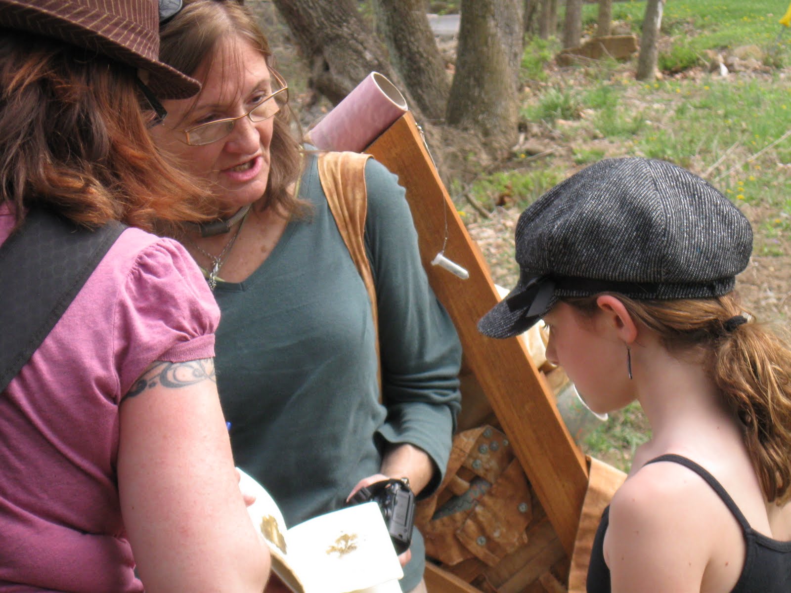
Basia Irland, a visiting artist at WVU. Many people walked, biked, kayaked, and waded the length of 
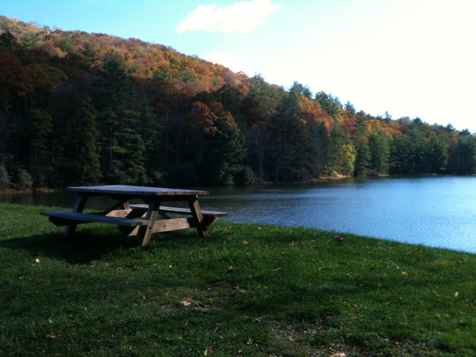
Decker's Creek, which if you aren't familiar, is an historic waterway that runs from Arthurdale through Morgantown.
Our group was made up of my cousin Malissa, her three daughters, her future sister-in-law, and me, Keith and Delia (and a dog, who is apparently really good at math). We symbolically carried the water in a baby stroller. Of course we did not actually get the water anywhere near the baby, because although Friends of Decker's Creek is working on improving the water quality, the creek water is contaminated by acid mine drainage and untreated sewer overflow. There are signs posted near the beginning of the Decker's Creek rail trail that explicitly warn people of the dangers hidden in the water.
Naomi got to carry the Symbolic Backpack. I thought that was cool until I heard the artist say they "painted" it with creek mud. I might be too sensitive to microorganisms and heavy metals, but that gave me the creeps.
Basia Irland seemed like a real nice lady. I hear she has done projects like this before with other waterways. She didn't seem too afraid of getting a staph infection from the water, so I guess I should just chill out about it.
Here Malissa is putting some creek water into the Symbolic Vessel that was made for the project. (which is somewhat funny to me, because Malissa and Nature have never been particularly close). By the time the Vessel made it to us, barely a mile from the end of the trail, it no longer had a stopper, and so the bag it was in and the logbook were all wet.

I guess my fear of waterborne illness really spoiled the whole thing for me. We didn't go on to the end of the trail because of poor planning on our part. We parted ways with the group after Malissa handed the vessel off to the next guy, who was WADING to the next stop. Brave Soul.
I have been known to revel in many a creek and never give a thought to where the water is coming from or what is in it. But Decker's Creek is orange, and I have read the warnings posted about the health hazards. I reckon that was the point of the exercise, to make people think about this waterway that runs through our town.
Up next. a few pictures of Decker's Creek.
Our group was made up of my cousin Malissa, her three daughters, her future sister-in-law, and me, Keith and Delia (and a dog, who is apparently really good at math). We symbolically carried the water in a baby stroller. Of course we did not actually get the water anywhere near the baby, because although Friends of Decker's Creek is working on improving the water quality, the creek water is contaminated by acid mine drainage and untreated sewer overflow. There are signs posted near the beginning of the Decker's Creek rail trail that explicitly warn people of the dangers hidden in the water.


I guess my fear of waterborne illness really spoiled the whole thing for me. We didn't go on to the end of the trail because of poor planning on our part. We parted ways with the group after Malissa handed the vessel off to the next guy, who was WADING to the next stop. Brave Soul.
I have been known to revel in many a creek and never give a thought to where the water is coming from or what is in it. But Decker's Creek is orange, and I have read the warnings posted about the health hazards. I reckon that was the point of the exercise, to make people think about this waterway that runs through our town.
Up next. a few pictures of Decker's Creek.
Subscribe to:
Posts (Atom)